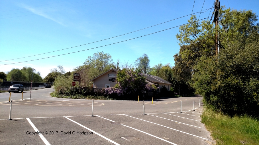
Partly-constructed roundabout in Healdsburg
On Saturday, Mary volunteered to help out with the six-month anniversary party for the Healdsburg branch shelter of the Sonoma Humane Society. I went along there during the afternoon to visit her.
On the way there, I had to negotiate a new road feature in Healdsburg that seems to be causing utter confusion: the new roundabout (traffic circle) at the south end of the downtown district.
The photo above shows traffic negotiating the roundabout. Admittedly, they’ve managed to make things as confusing as possible: there are no road marking for the roundabout, there’s a distracting mass of bollards and traffic cones all around it, there are no directional or exit signs, and there are no marked crosswalks. Not surprisingly, many motorists are completely confused, and vehicles are stopping in the middle of the roundabout.
Surprisingly, roundabouts are still quite rare in California, even though they were originally an American invention. As a result, few California motorists have ever encountered them, and they certainly don’t feature in the State driving test.
Hopefully, the arrangements in Healdsburg will be better when the roadworks are completed and the traffic islands are constructed. The photo below shows the Parish Cafe, which is next to the roundabout, wasn’t demolished, and is open for business.

Parish Cafe, Healdsburg
Even when it’s finished, this roundabout will have a special feature that should continue to cause confusion. The railroad line from Santa Rosa to Cloverdale passes directly through the roundabout, and, according to the city plan (http://healdsburgaveimprovements.com/), will continue to do so after everything is complete. There will actually be crossing gates within the roundabout, to stop traffic when a train appears!
At present, however, the SMART line doesn’t extend further north than Sonoma County Airport, so the old tracks that passed through the site of the roundabout have simply been lifted. The existing tracks are derelict anyway, and will need to be replaced before SMART trains can run. The photo below shows the track heading towards the roundabout.

Railroad, Healdsburg, looking north towards the new roundabout


 Yesterday (Martin Luther King Day), Mary and I visited