

When I was exploring the streets of Scarborough in 1977-78, conducting research for my A-Level Art project on architectural aspects of the local road and rail industries, it was impossible to know what the future might bring for the subjects of my study. Many of those locations and buildings have in fact survived to the present day, and some have even been renovated. Others, however, have vanished completely. In some cases, even the land on which the buildings stood has been redeveloped to the extent that it is now unrecognizable.
The subject of this article is one such example. Westwood Bus/Coach Station occupied a central site in Scarborough, right next to the main railway station. During the 1970s, the bus station was still quite heavily used, particularly during the summer months, when it was often completely filled with visiting excursion coaches. It was also still the terminus for scheduled bus services. During the 1980s, however, the station was shut down, and the entire hillside on which it stood was excavated to create a new superstore and underground car park, which still exists today. As a result, no trace remains of this bus station.
The image above is a digitized version of a gouache painting that I produced for the A-level thesis. It is to scale and shows the northerly elevation of the waiting room and ticket office building at Westwood, which was the only permanent structure on the site. If you don’t like the color scheme, please don’t complain to me! Those were the actual colors of the building at the time of my survey; very “Seventies”!
Note that the location described in this article is not the East Yorkshire bus park currently referred to as “Westwood”. The old location was on the south side of Westwood, where the Tesco store now is. At that time, the current bus park was part of Scarborough railway station.
Three Bus Stations
I’d been familiar with that place for as long as I could remember. When I was very young, Westwood was the terminus for services operated by East Yorkshire Motor Services (EYMS). At that time, there were two other regional bus companies running services into Scarborough, but each had its own station. United Automobile Services used Valley Bridge Bus Station, whereas West Yorkshire Road Car (WYRC) used a station on Northway.
During the late 1960s, after all three companies had become part of the National Bus Company, operations were merged, and the opportunity was taken to reduce costs by eliminating some of the facilities. Northway was closed in 1970, and WYRC services then operated from Valley Bridge. Similarly, EYMS ceased to use Westwood in 1970 (see letter below), and transferred its operations to Valley Bridge.
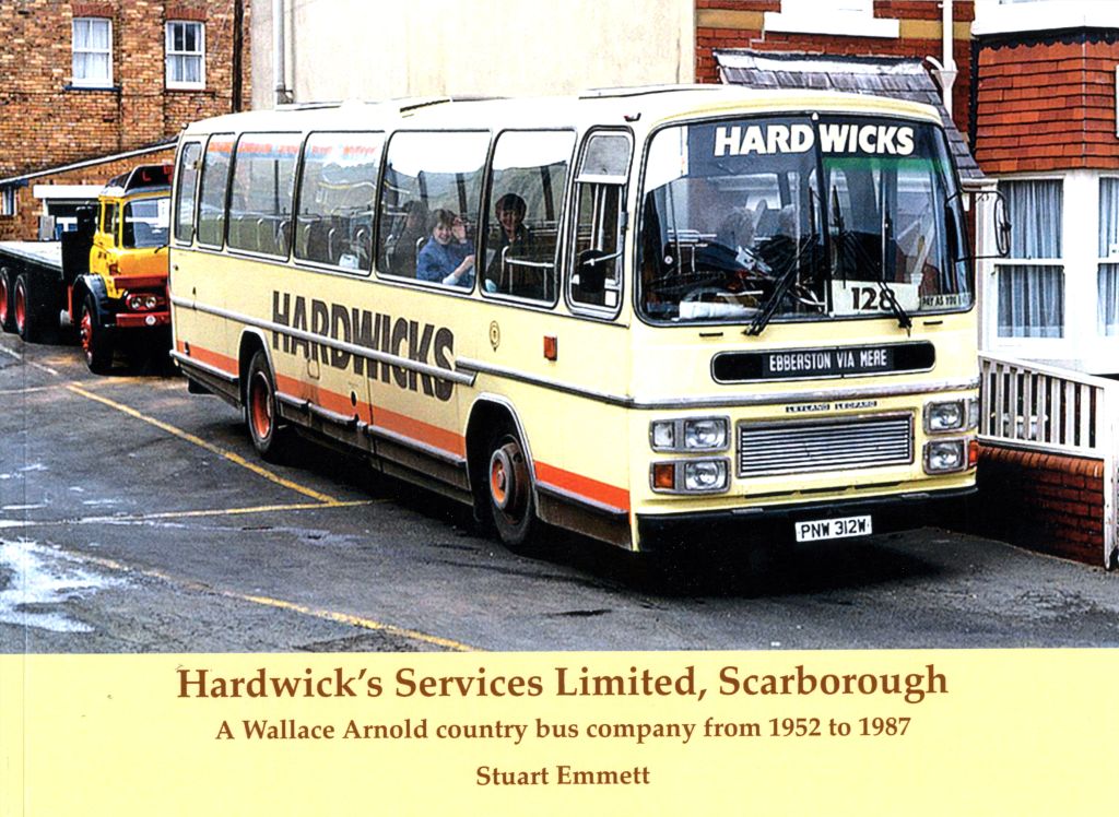
Another independent user of Northway Bus Station prior to its closure had been Hardwick’s Services, which was a company owned by the famous holiday tour operator Wallace Arnold. Following Northway’s closure, Hardwick’s began to use Westwood as the terminus for its scheduled services to Ebberston.
As such, by the time of my study, Westwood was used only for Hardwick’s Services, and to handle summer excursion traffic visiting Scarborough. I didn’t specifically take any photos of the bus station, but mostly of vehicles that happened to be parked there.
The photo below does show part of the site. The view is looking towards Valley Bridge, with Westwood on the left. The building that I drew is on the right. In the foreground is a former Mansfield District Bristol Lodekka, which was in use for driver training.

An Undeveloped Prime Location
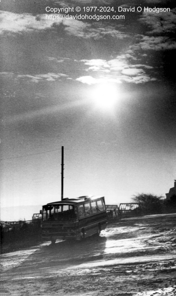
It always struck me as odd that the site of Westwood Bus Station was relatively undeveloped, given that it was in a central location right next to the railway station. There was only one building, and the concrete parking surfaces were steeply sloped, having never been leveled. Parts of the parking area were never even concreted, and were simply filled with stone rubble, as shown in my photo below.
Surely such a site would have been snapped up by an eager developer for construction of a hotel or some similar profitable structure.
I eventually discovered that the reason for this was that the land on which Westwood stood was railway-owned. It had been bought up in the late nineteenth century by the North Eastern Railway (NER), with a view to the extension of Scarborough Central station. However, the railway’s planners soon realized that, due the existence of villas immediately west of their newly-acquired land, it would be impossible to create the necessary fan of extra lines to extend the station footprint there.
As a result, the NER dropped that plan and, instead, in 1907 constructed an entirely new station further west at Londesborough Road, on the site of a former goods depot. Additionally, a new complex of sidings was built alongside the Scarborough-Whitby running line at Northstead. This arrangement proved very effective for handling the extra excursion traffic that Scarborough experienced every summer, so the land in Westwood was no longer needed.
According to an old photograph that I’ve seen, the railway-owned land was let out for allotments until after World War II. When EYMS needed a new bus station in Scarborough during the 1950s, British Railways presumably sold the land to them (EYMS was by then part of the privately-owned British Electric Traction group).
While researching my A-level Art project, I could find very little published information about Westwood, so I wrote a letter to EYMS directly, requesting some details. The letter below is the response I received from them.

The book Prestige Series: East Yorkshire, by John Banks, shows color photos of Westwood on the front and back covers, and there are several monochrome photos of the location inside the book.

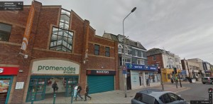
As I mentioned above, the entire site was excavated during the 1980s, and a Hillards supermarket with underground parking was built on the site. Hillards was taken over by Tesco in 1987. Here is the current Google Streetview of the Tesco supermarket from Westwood. Due to the redevelopment, it’s no longer possible to stand in the location from which I took the 1977 photo above.
Hardwick’s Services
My photo below, taken in Winter 1977, shows the buses of Hardwick’s Services using Westwood as their Scarborough terminus. As you can see, Hardwick’s used vehicles with Plaxton coach bodies, but fitted with bus seats. Presumably the reason for that was for parts interchangeability with other vehicles in the Wallace Arnold fleet.
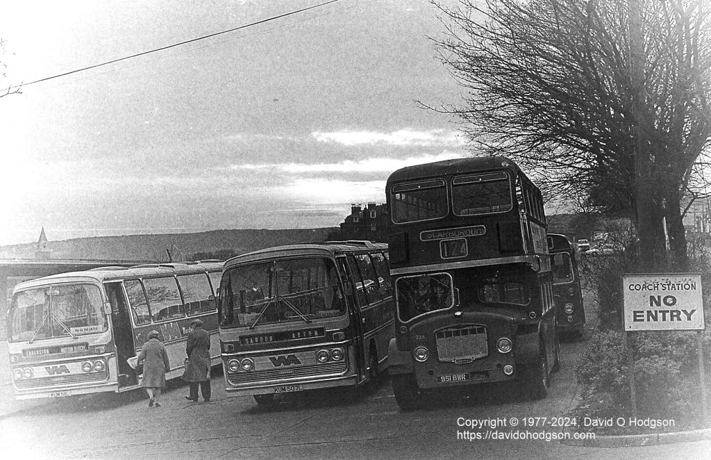
As is visible in the photo, NBC buses were still sometimes parked temporarily at Westwood, because there wasn’t sufficient space in the nearby Valley Bridge Bus Station, and Westwood was closer than the United depot on Vernon Road.
Incidentally, the vignetted and “frosty” look of my photo was accidental; during cold-weather development of the negatives, I failed to wash off the fixer properly! However, in this case I liked the effect, so I kept it.
Full details and history of Hardwick’s Services can be found in this book.